Pages

Showing posts with label Trail Tales. Show all posts

Wednesday, September 25, 2019

Elderberry Canyon Trail


Elderberry Canyon, located in the Libby Creek drainage, has no elderberries. At least, from what I observed on a recent foray. I could be wrong. My attention was oft distracted by views of silvery granite peaks of the Sawtooth range, adorned by seasonal colors of golden larches. 
If you are looking for a short and sweet, in and out, close to town, and relatively flat walk, Elderberry Canyon is one option. To get there, travel one mile south of Carlton, and turn right into the Libby Creek drainage. After 3.6 miles, take the left fork and continue on Libby Creek Road for about a quarter of a mile. An old forest road sign indicates “Elderberry Canyon Road End, 2”. The first portion of this dirt road is private. If driving a high-clearance all-wheel drive vehicle, you could drive to the end of this two-mile rutted road and park in a small clearing. Otherwise, park alongside Libby Creek Road. Do not block the entrance, and do not stray from the easement.
Elderberry Canyon trail begins at the end of this two-mile rutted and overgrown jeep track. Wide and shaded, the trail is a roadbed that gently climbs for approximately two miles through red ponderosa pine, dressed in brilliant wolf lichen. At two miles, the trail disappears into a small meadow. Lookout Mountain rises ahead, and the ambitious hiker in search of views can continue on the open ridge line to the lookout. 
This gem is a go-to trail for all seasons. In the spring, yellow balsam and spring beauties carpet the forest floor and frame the views of the Sawtooths. In summer and fall the shaded roadbed is an easy mountain bike ride with rewarding views. Elderberry Canyon is accessible in winter, as Libby Creek Road is reliably plowed. Skiers and snowshoers should look for wider parking pullouts at the junction of Libby Creek Road and Smith Canyon Road and walk the quarter mile to the beginning of Elderberry Canyon Road.


Sunday, September 15, 2019

Harts Pass to Grasshopper Pass


Original publication, Methow Valley News, September 4, 2019


The holiday weekend crowds were delightfully sparse along the Pacific Crest Trail between Harts Pass and Grasshopper Pass. A parking spot was available, there were no lines at the outhouse, and the hikers were stretched few and far between.
All the elevation was gained via Harts Pass Road 5400. The road climbs above 6000’ in elevation into the heart of the North Cascades, where Hart’s Pass accesses a network of trails into the vast Pasayten Wilderness. 
Hart’s Pass is the highest road in the State of Washington. Built in 1893, the route gave access to gold and silver mines and over 1,000 permanent residents. According to “High Hopes and Deep Snows, How Mining Spurred Development of the Methow Valley,” author Marcy Stamper states the town of Barron near Harts Pass served 2,500 miners with a post office, a butcher shop, a trading company, several restaurants, gambling establishments, and “dancing women.” The road is named after Thomas Hart, the mine owner who built the road to transport equipment and ore. When the gold ran out, so did the people. The town of Barron was hastily abandoned in 1907, people left just as quickly as they first appeared, leaving tools of trade and personal belongings behind. Sally Portman, in her book, “The Smiling Country” relays the humorous account of sisters Ruth and Florence McLean camping up at Hart’s Pass with their family in 1910:
              “The two sleuths dove into some old boxes left in haste by former dance hall girls and delightedly lifted out fancy-lady dresses…Florence put on one and started running as fast as she could up the path. When asked why she was running away, Florence answered, ‘I heard this dress belonged to a fast woman and I’ll bet I’m just as fast as any of them.’”
All that remains today are the views that leaves one either speechless or reaching for superlatives. Summer flowers are still in limited bloom, while other blooms have dried to perfection on the stem. The larch will turn golden in a few short weeks. The hike from Hart’s Pass to Grasshopper Pass is relatively easy and flat, following the ridgeline along the Pacific Crest Trail. To get there, travel Lost River road from Mazama to the end, continue the gravel forest service road 5400. At roughly 13 miles on 5400, the road forks. To the left is Meadows Campground, straight on is Hart’s Pass. There are many trailheads and views at Hart’s Pass, but for this hike, I recommend turning left and heading towards Meadows Campground. At another fork in the road, the left leads to the campground, while the right fork continues to Brown Bear Trailhead. Take the right fork and park at the Brown Bear Trailhead. 
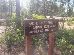
Follow the trailhead to the Pacific Crest Trail mark. A large sign indicates left to Glacier Pass, and right to the Canadian Border. Turn left. Grasshopper Pass is 4.7 miles from this trailhead. A detailed trail description with mileage and points of interest can be found at https://www.wta.org/go-hiking/hikes/grasshopper-pass


Wednesday, April 10, 2019

Wells Wildlife Area


This article first appeared in the Methow Valley News, April 10, 2019

Any fan of Steve Martin’s hilarious comedy, “The Jerk,” will remember his uncontrollable excitement when the new phone books arrived.
I re-enact that scene every spring, with slightly different words. “The new blossoms are here! The new blossoms are here!” Or, “The birds are back! The birds are back!” Or, my favorite sentiment, “The trails are open! The trails are open! Things are going to start happening for me now.”
Some of the lower-elevation trails are ready for traipsing, including the Golden Doe area south of Twisp. That trail has everything: buttercup blossoms, mountain views and wetlands filled with birds. A recent foray yielded views and songs from redwing blackbirds, spotted towhees and western meadowlarks. For details on the Golden Doe unit of the Methow Wildlife Area, access the Lower Valley column from last year.
If you are looking for a cure to cabin fever, wide open spaces with long-range views are the balm-diggity. (I just made that term up, patent pending.) For views of the Cascades, a symphony of bird songs and glimpses of the mighty Columbia, I highly recommend an excursion to the Central Ferry Canyon Unit of the Wells Wildlife Area. Over a thousand acres — 1,914 to be exact — of shrub steppe and mixed forest provide the perfect backdrop to birdsong resonance in the mornings and late afternoons.
To find the Central Ferry Canyon Unit of the Wells Wildlife Area, cross the Columbia River at the bridge in Brewster. You can’t miss it. It’s the only bridge in Brewster. Turn right on Crane Orchard Road. Travel for 3.3 miles and turn left on Central Ferry Canyon Road, a well-maintained dirt road. Follow Central Ferry Canyon Road for a little over a mile until entering the Wells Wildlife Area, marked by a sign.
In the wildlife area there are three different parking areas off the main road, all marked by Discover Pass signs. Not all areas have maintained trails. For a distinct jeep track trail, I recommend following Central Ferry Canyon road up towards the ridge and using the third parking area found on the left-hand side of the road, below the tree line. For more information on the Central Ferry Canyon Unit of the Wells Wildlife Area, visit https://wdfw.wa.gov/places-to-go/wildlife-areas/central-ferry-canyon-wildlife-area-unit.
For those who enjoy a picturesque walk amongst gravestones, Packwood Memorial Cemetery is located at the top of the ridge, within the pine trees.
Finish up your excursion with a meal at Camperos Mexican Restaurant. The colorful décor is as much a feast for the senses as is the menu. The walls are a canvas of brilliant murals depicting orchard life in Brewster, and a nod to Mexican ancestry and culture. Camperos is located at 301 E. Main Ave. in Brewster. Or, get a feast to go from La Milpa, featuring amazing fresh-baked Mexican pastries, and family platters from their deli. La Milpa is located at 324 E. Main Ave. The chili rellenos will have you channeling Billy Idol, “More! More! More!”


Wednesday, July 11, 2018

Scatter Lake Trail


This article originally appeared in the Methow Valley News on 11 July 2018

A fun thing I might do again, but not anytime soon, is the 4.5-mile, 4,000-foot climb to Scatter Lake.
First, I need to regain feeling in my quadriceps, gluteals, hamstrings, calves, and foot flexors. The entire group of muscles in each leg feels like a tub of jell-o. Or like that wind sock guy that jerkily jerks over parking lots full of shiny new cars.
Here’s what happened: in a fit of early summer fever, I yearned to hike into a high mountain lake. Something cool and deep, ringed in snow, with the still surface mirroring the surrounding peaks. One morning, I leaned over a topo map spread out over the kitchen counter. The next morning, we were high stepping it to Scatter Lake.
For a visual of the climb to Scatter Lake, check out google maps. Enter “Scatter Creek Trail Twisp”, select “Maps”, and then hover over the drop-down menu on the top left corner and select “Terrain”. If what you see looks very much like a four-mile vertical climb…that’s the one.
My husband, who has the gift of foresight, (i.e. 20+ years of experience with my eyes-bigger-than-my-hiking-ability impediment) suggested that we take a leisurely approach to the trail and turn it into an overnight backpack. It was very pleasant to not feel rushed, and to just enjoy the trail knowing that we had all the time in the world to soak it all in.
The first 1/4 mile begins on the Twisp River Trail, a gentle meander that could be continued if one would like the use of their legs the following day. But, if jelly-legs and high mountain lakes are calling you, take the Scatter Creek trail that branches off towards the right.
The first mile of Scatter Creek Trail is pleasantly wide and appears to follow an old road bed that is over grown and narrowed to a single track. The grade is gradual through a shady forest.
The second mile is loaded with switchbacks, steadily climbing out of the valley. Through breaks in the tree cover, tantalizing views of snow packed ridgelines promise bigger and better views further up the trail.
The third mile laughs in the face of trail engineering and moons the “10% grade” standard of trail design. Switchbacks are swapped out for sloping meadows. Although the map and trail notes state that the trail follows Scatter Creek, the creek is an inaccessible roar below the trail. Be sure to carry enough water to stay hydrated.
While the third mile is steep, the fourth mile is straight up, with sections of loose rock and scree that can be a challenge on the way back down. The trail crosses several small streams, the largest being Scatter Creek.
The fourth mile ends in a beautiful meadow. Scatter Creek Falls rises above the meadow, as does the lake basin and the final half mile push to Scatter Lake. The leg burn is totally worth the stunning views and the peaceful surroundings.


Thursday, May 31, 2018

Hiking Methow Valley - Pipestone Canyon


We have a small window of marvelous color now that the mud has retreated and before dust season settles in. This in-between season, some call it spring, is fleetingly magical. Sunlight illuminates each fold in topography, a dappled green landscape of lustrous light and shadow. Rainstorms fill a maze of hills and valleys before crashing into rocky crags of a high mountain peak. Flowers bloom in different hues and scents: the lupine, balsamroot, indian paintbrush, wild rose, shooting stars, buttercups, blue bells, and a myriad more cover hillsides in swaths of color.

This is the best time to enjoy many lower elevation trails in the valley: before the heat of summer arrives, and rattlesnakes emerge. One such trail is Pipestone Canyon.

Most users access Pipestone Canyon and the Rim Trail near Campbell Lake from the Winthrop side. Unfortunately, Lester Road is filled with water and mud, easily eroded by wheels. I also have unconfirmed reports that the Rim Trail is forming new canyons with the seasonal runoff. Last year I noticed a whole section of the trail gave way to a fresh geological transformation.

A different approach is to hike Pipestone Canyon from the bottom up. To get to the lower trailhead, take Highway 20 towards the Loup. Travel three miles from the WA-153/WA-20 intersection before turning left onto Upper Beaver Creek Road. After 2.5 miles, take another left onto Balky Hill Road. Travel for half a mile and find a closed, unlocked gate on the right side of the road next to a ‘no parking’ sign. Close the gate after driving through. The road is unmaintained and rocky. Travel along this road for another half mile to a wide parking area marked with a Discovery Pass sign.
From the trailhead, you can see two distinct drainages - head towards the one on the right. The trail follows the curvature of a hill on the east side of a grassy meadow with pockets of wetland areas. I think this is one of the more dramatic approaches to Pipestone Canyon, as the steep canyon walls rise like sentries around the bend in the meadow.

It doesn’t take a geologist to see the dramatic storyline embedded in the walls of Pipestone Canyon. But it does take a geologist to decipher and translate the language of stone.
Starting in the summer of 1939, Dr. Julian Barksdale began studying the geography of the Methow Valley. At times, he worked as a cook for a pack-horse outfit to gain transportation into the backcountry. Dr. Barksdale never published his work, stating that the remoteness and ruggedness of the Methow Valley, combined with the complex geology was too “enormous a project” to undertake. Still, his findings were deemed valuable knowledge and in 1975 the DNR published a copy of his work.

The 1975 DNR report includes evidence of temporary periods of lake development, when fossils of plant life were preserved. Using Barksdale observations partnered with 1950s studies of fossilized plant life, the report dated the Pipestone Canyon formation to the Paleocene epoch, 66 to 56 million years ago…while at the same time noting that some formations contained evidence from the Cretaceous period, over 100 million years ago.

Over the years, geologists have studied the area in greater detail and found more samples dating to the late Cretaceous period. Geologists now know that the Pipestone Canyon Formation contains vast amounts of data showing tectonic plate movement, folding, fault lines, and glacial carving. A simple google search of “Pipestone Canyon Formation” yields a multitude of articles describing this geologic drama. Or, simply take a walk and enjoy the view for yourself.
This article originally appeared in the Methow Valley News, 09 May 2018

Hiking Methow Valley - Golden Doe


I love the winter. I love the spring. I’m not a big fan of mud season.
Mud season is a tease with reassuring sunny skies above and treacherous footing below. Either the trails are socked in with mushy snow, or stream crossings are impassable by high water torrents of turbulent runoff.

There are not many options for shoulder season hiking, but the lower valley offers up some hidden gems that are best enjoyed before the heat of summer, and before rattlesnakes become active.
One such gem is the Golden Doe unit of the Methow Wildlife Area. Nestled beneath the McClure scar, in a narrow hanging valley the Golden Doe area is 1,514 acres of shoulder season beauty, complete with mountain views, riparian areas, forested trails, and open meadows.

Starting from the Methow Valley Community Center, set your odometer to zero and head down Twisp Carlton road. The hidden driveway is five miles from the community center, on the right side of the road. The driveway takes a sharp turn to the left and goes uphill to a parking area in front of a haunted cabin. You’ll see what I mean when you get there.

Follow your ears to the sound of Alder creek and find a locked gate with a pedestrian-sized opening. Follow the jeep trail up a gently sloping hill, keeping Alder Creek on your right. The trail turns left and opens into a wide sweeping meadow encircled by small rounded hills. The trail may disappear into the grasses. Look for it to reappear on the hillside to the west. Follow the trail up and over this hill, where it becomes apparent once more along a barbed wire fence.

At a quarter mile, Alder Creek widens into a large wetland area, full of redwing blackbirds. The trail continues up above the wetlands for another quarter mile before it bisects two hillsides to enter the small valley at the base of Mt. McClure. Here, the trail splits. Turn right and travel north for forested hiking and views of McClure. Turn left and travel south for open meadow hiking.
The south bound trail follows the base of the hillside until the hanging valley spills into open farmland. At this point, follow the trail east up and over a small saddle. The trail again disappears into the grasslands as it drops down into a meadow. Two deep craters whisper of glacial lakes long gone. This meadow is typically full of mountain bluebirds in the early spring morning. Walk around the edge of the meadow and stay along the base of the hillside, traveling north for about a mile to intersect once again with the beginning of the trail near Alder Creek.

Golden Doe is part of the larger 31,000-acre Methow Wildlife Area. Beginning in 1941, the USFS began purchasing private parcels in an effort to contain damage done by mule deer on local farmland. The seven parcels form a migration corridor and provide protected habitat for other wildlife, including songbirds and salmon. All seven units are open to the public for wildlife viewing, hunting, fishing, hiking, horseback riding, and cross-country skiing. The seven units are Big Buck, Big Valley, Early Winters, Methow, Rendezvous, Texas Creek, and Golden Doe. For detailed maps of each area, visit Washington Department of Fish and Wildlife https://wdfw.wa.gov/lands/wildlife_areas/methow/
This article originally appeared in the Methow Valley News, 2 May 2018

Thursday, November 5, 2015

Golden Lakes


Oh look, a column. They appear like magic. I hoped somebody reads this trail tale. I hiked all the way uphill just get this story.

Published in the Methow Valley News , October 28, 2015


Larch trees blend in with other conifers most of the year, but when autumn arrives, they reveal their true colors. Deciduous needles change from dark green to brilliant yellow. The Golden Lakes Loop trails on Gold Creek are  — to continue a literary theme — pure gold.
To get there, take Gold Creek Loop to Gold Creek Road. Follow the main fork of Gold Creek for about 6 miles before coming to a marked fork in the road. Turn left onto forest service road 4340-300. Arrive 4-1/2 miles later at the trailhead parking lot at the end of the road. Both the turnoff and the trailhead are marked, but there are no destination signs. Someone keeps taking the signs, including the trail register. The trailhead is primarily referred to by two different names in trail books: Eagle Lakes, and Golden Lakes Loop.
There are usually several cars parked at the trailhead, as this is a popular trail with stunning views. A meadow campground with picnic tables, grills and an outhouse is perfect for overnight camping at the trailhead, for an early start in the morning. Interconnecting trails lead to multiple high-alpine lakes, surrounded by brilliant larches, heather, bearberry, salmon berries, willows, dogwoods and aspens — all showing their stunning fall colors; truly, a hikers paradise.
Most hikers come from miles away to hike the ever-popular Golden Lakes Loop, which includes Martin Lakes, Cooney Lake and Eagle Lakes. If you have two or three days for an overnight hike, or feel like a long bike ride, this 23-mile loop is well worth the time.
For a quieter, less-traveled hike, Crater Lake is a wonderful option. Just 4-1/4 miles from the trailhead, a round-trip day hike is challenging, yet rewarding, with a steady elevation gain of 2,350 feet from the trailhead to the lake, which is located at 6,969 feet. Rugged beauty surrounds the jagged cirque of Crater Lake, where calm waters reflect the warm hues of the changing larches.
Start from the Eagle Lakes Trail, which gently climbs the Crater Creek drainage through open forest with fir and aspen. At a quarter-mile, the trail dramatically opens with views of both Crater and Martin Creek drainages as the path curves along a rocky ledge. At thr .07-mile point, an impressive bridge crosses Crater Creek and the trail enters a shady spruce grove. Here, the options begin: Martin Lakes, Cooney Lake and Eagle Lake trails are to the left, while Crater Lake Trail veers to the right. The trails are clearly marked.
Crater Lake trail is steep, but there are many rock outcroppings that provide perfect photo ops to capture long views of the Methow Valley floor, expertly framed by tree-covered slopes.
Lower Crater Lake is at the4-mile mark, in a deep basin surrounded by 8,000-foot rocky crags. Upper Crater Lake is just .03 miles further.
For a longer day hike, Martin Lakes are a 12-mile round trip, as are the Eagle Lakes. Cooney Lake is a little farther, at 7 miles in. All are within a 14-mile round trip. Happy hiking!


Monday, September 14, 2015

I was a vision of loveliness

White shirt, broad brimmed taupe hat, blue swim trunks.
Paddling across a cold alpine lake, trees along the shoreline turning their leaves in the autumn sun...
Loki enjoying the ride in the front of the kayak. Suddenly she whirled around and frantically licked my face - her way of saying, "I've got to poop. RIGHT NOW!!"
I quickly paddled to the closest shore, trying to avoid her lashing tongue - paddle bonking her on the head with every stroke.
I say, "we're almost there," she turns, and seeing the shoreline, leaps out of the kayak and swims to shore...only to get mired chest deep in black, inky muck.
She works her way free and bounds uphill, a look of happy relief as she finished her business. Meanwhile, I paddle over to a large boulder where she could jump from dry land to boulder to kayak and avoid the muck.
On her way down hill to the boulder she stopped in pleasant surprise. A cow had left a large fresh steamy pile...just for her. She flipped on her back and gleefully slid downhill, wiggling to ensure her fur was adequately coated, her muck-blackened legs happily pawing the air.
She hopped on the rock, ever so pleased with herself. Bottom half covered in black muck, top half covered in dung. A thick glob of mud slid down her side and landed with a loud kerplop on the rock. I tried to kick off from the rock, hoping she would instead swim alongside the kayak, but I wasn't fast enough. Loki leaped through the air and belly flopped into the kayak, her hind legs kicking in the water. Realizing that she was now "splashing", her other favorite activity besides rolling in shit, she made no effort to either get in or out of the kayak, as she was having much more fun splashing the water with her hind legs, sending splatters of dung and mud all over me and my white shirt, and my lovely broad brimmed taupe hat.
Nearby, in the other kayak, sat Joe and Shasta. Joe laughed hysterically. Shasta sat in quiet response, reclining in the bow like the queen of the Nile, her eyelids half closed in an afternoon nap.

Thursday, January 8, 2015

Trail Meals

Here are just a few ideas for tasty picnic meals in the backcountry :)

Some basics that I always take:
  • small squeeze bottle of honey
  • small bottle of olive oil
  • nut mixture (sunflower seeds, plain almonds, flaxseed – all ground up together with a food processor)
  • apples
  • tea bags
  • coffee
  • Costco makes the BEST dried fruit mix – kirkland – in a big yellow bag – strawberries, kiwi, banana, mango, apple, walnuts

 Breakfasts

  • Plain organic oatmeal with dried fruit and nut mixture, with a squeeze of honey
  • Dehydrated milk and granola cereal
  • Dried fruit and granola bar

Lunches

Tuna fish with chopped up veggies and olive oil (tuna in individual sized foil packets, chopped carrots, onions, broccoli) on crackers or bread
  • Chop veggies before hand and place in quart sized ziplock bag
  • When ready to eat, add tuna and oil to bag, squeeze gently to mix
Dried fruit, granola bar, turkey jerky
Bagel with salami and cheese

 Dinners

Curried Veggies
  • Instant rice serving for two
  • Two tablespoons tomato paste and two teaspoons Indian Spice Mix in a snack sized ziplock bag
  • Chopped sweet potatoes, green beans and any other veggies in a quart sized ziplock bag
  • Small can sweet corn, small can garbanzo beans
  • Olive oil
  • Pita bread
In measured boiling water for the rice, cook the raw veggies for just two minutes before adding the rice. Add rice, tomato paste, spice mix, oil, and canned/drained veggies – seal and wait for rice to absorb water. Heat bread in dry pan

Classic Thanksgiving Meal
  • Foil packaged pre-cooked chicken
  • Single serving herbed/garlic dehydrated mashed potatoes
  • Half a bag of Stove Top Stuffing
  • Dehydrated gravy mix to taste
  • Dried cranberries
  • Green beans
  • Salt and pepper
  • Paprika
Bring 2 cups (16 oz) water to a boil. Stir in all ingredients, cover, and let sit for 5 minutes. Enjoy

What to Pack for Day Hiking or Backpacking

I am often asked what to pack or bring along on a hike. Here is a list of items that I always bring, and are recommended by rescue professionals. 

Safety

  •  Always tell someone where you are going and when you plan to get back.
  •  Dress in layers and prepare for rain, the mountain front usually experiences surprise showers on otherwise clear days.
  •  Wear proper shoes that fit well and have a good tread.
  •  Always bring water and a small first aid kit.
  •  Wear sunscreen and a hat – heat stroke can happen to anyone and is easily avoidable.
  •  Bring a cell phone and a list of necessary numbers.

First Aid Kit

  • Small roll of duct tape - good for mending clothes, gear and protecting blisters
  • Large safety pin
  • Band Aids
  • Athletic tape for wrapping sprains
  • Burts Bees Res-Q ointment - good for scrapes, burns, stings
  • Alcohol wipes
  • Aspirin
  • Benadryl
  • Anti Diarreal
  • Small swiss army knife with tweezers
  • Lighter/matches/fire starter (cotton balls with vaseline work great)
  • Water purification tablets
  • Sunscreen
  • Thread and needle

Day Hike Packing List

  • First Aid Kit
  • Light weight rain jacket
  • Sunscreen
  • Wide brimmed hat
  • Snacks - granola bars, whole fruit
  • Water - at least 32 oz.
  • Walking poles - these transfer up to 25% of the load from your legs to your arms
  • Wet wipes, and extra zip lock bags
  • Small trash bag to carry any trash - pack it in, pack it out!
  • Camera/Binoculars/Pocket Trail Guide/Maps

Overnight Backpacking List

Everything from the day hike list plus:
  • Light weight underlayer for chilly evenings - top and bottom
  • Light weight rain jacket/pants
  • Stocking cap and gloves
  • Sleeping pad
  • Sleeping bag
  • Reading material
  • Headlamp/Flashlight
  • 2-3 handkerchiefs to clean up with
  • Biodegradable soap - Dr. Bronner's Magic Soap is good for both body and dishes
  • Toothpaste/toothbrush/floss (yes, floss - floss every day otherwise your mouth stinks. Trust me)
  • Water tablets for purification - the new ones do not have any aftertaste
  • 2-3 water bottles - one gallon of water a day per person
  • Camp shoes - flip flops or crocs work well
  • Small campstove and pans for cooking
  • Utensils
  • Tent or groundcloth
  • Small, lightweight backpack or bag to take on day hikes from base camp

Tuesday, July 1, 2014

Foggy Dew - Merchants Basin - Angels Staircase - Boiling Lake - Horsehead Pass - Eagle Lakes

Foggy Dew - Merchants Basin - Angels Staircase - Boiling Lake - Horsehead Pass - Eagle Lakes


I woke up to a strange ripping sound and a shower of ice crystals in my face.
“Joanna, wake up, the tent is falling down.”
In response, my eyelids squeezed shut even tighter as I burrowed deeper into the warmth of my sleeping bag.
“Joanna…”
With a grunt I shoved only a single hand out of my warm cocoon and fumbled around until my fingers found the faulty pole and pushed it back upward, causing another cascade of ice crystals to shower down. Joe secured the pole back into position with a Velcro loop.
Or, I assume he secured it. I was still fully cocooned in my mummy bag, eyes shut tight to the early morning sun cresting over Foggy Dew Ridge.
The day before was a steady climb past boulder fields, tumbling springs and Foggy Dew Falls. The trail turned nearly vertical at the lip of Merchants Basin. The meadow bowl was filled with sunshine and soft green grass, the edges of the basin lined with snow. A few yellow glacier lilies spotted the landscape.
After a leisurely spell in the meadow, the trail slowly climbed up a ridge to overlook Cooney Lake, still locked in by snow. A sharp turn to the left took us along the ridgeline and rewarded our steady uphill climbing with positive altitude and angelic views looking down the valley towards Stehekin.
Storm clouds flowed through the corridors of mountain peaks, sunlight slashed holes through the darkened masses, illuminating the valley below. The wind tore words of awe from our lips and we bent our heads in acquiesce to descend Angel’s Staircase into yet another high altitude meadow, this one as darkened by storm clouds as the other was brightened with sun.
The evening was quiet, yet cold. The night colder still. And in the morning, the sun – and a fallen tent pole – revealed icy stalactites that had formed overnight on the fabric directly above my head.
Our companions, Scott Rudy and Sandee McKinney of Hayden, Idaho, spoke of “backpacker amnesia” as we packed up camp and shouldered our bags for the next leg of the trail. Backpacker amnesia usually occurs the morning after, when the beauty of the surroundings overrides any muscle aches or coldness that linger from the night before.
Boiling Lake appeared suddenly, still and tranquil. I had read that bubbling springs create the illusion of boiling in the lake when seen from above. As we climbed Horsehead Pass I kept looking down to witness this phenomenon, but the surface of the lake remained calm and serene.
The views from Horsehead Pass were just as breathtaking as Angel’s Staircase, only this time it was the scenery and not the wind that took our breath away.
More flowers lined the path along the Eagle Lakes trail. The colors crossed the spectrum of red, orange, yellow, green, blue, indigo and violet.
Our day ended much too soon, along this epic trail in the lower valley. Early summer, in that space in between the melting of the snows and the heat of high summer, this trail is resplendent with wildflowers. In the fall, the larch trees are the draw, their golden glow magnificent in autumn. A trail worthy of many visits.

Sunday, September 30, 2012

Joe's Epic PCT Adventure


My partner Joe spent the summer of 2012 walking to Canada along one of the most famous national scenic trails in the world: the Pacific Crest Trail
Jealous? I know I am.
Just the necessities on your back. You and nature: wind, rock, water and the fire rim of the Pacific Crest.
Finding good conversation and cold beer along the trail. Yeah, he enjoyed every minute of it.
  • 3 states
  • 6 ecozones
  • 7 National Parks
  • 19 major canyons
  • 60 major mountain passes
  • 1000 lakes


Photo Albums on Facebook:
Mile 1-500  |  Mile 500-1000  |  Mile 1000 - 1500 | Mile 2000 - 2500 | The Final Leg

April 17, 2012

Trail angel "Frodo" picked us up at the San Diego airport along with fellow hiker Kevin from Kentucky. Frodo and her husband Scout organize transportation and lodging for PCT hikers who arrive in San Diego. That evening, we enjoyed an incredible meal at their home and met several other hikers who were enjoying their hospitality as well. Pepper and Chili - a father son team from Florida, LB - a full bearded red head who had just ridden his bicycle from St. Augustine Florida to San Diego, Hannah from New Zealand, and Kimberly from Oregon rounded out the crew. After dinner everyone swapped favorite backpacking and trail stories while Scout played the guitar.They had all completed either the AT or PCT in previous years.

April 18, 2012 - The Beginning!

7:00 a.m. We started off at the PCT monument along the Mexican border at Campo, California. The border police were out in full force, trolling the metal wall that looked like pieces of old scrap metal from boxcars that had been welded together. A prime example of "shackitecture"
There were several other people starting with us, we would learn later that a total of 24 people had started the trail that day.
The arid chaparral desert is dense with plant life - something was in bloom in every corner. Tall, full bodied yuccas, flowering pacific yews, white popcorn flowers, purple sage, indian paintbrush and many many more blossoms that I don't know the names of. Water was in short supply, so we carried several gallons between the two of us.
Over the next 16 miles that day we would find discarded gear - some clothing, food, a water bladder, tarp, sleeping pad...helicopters were a constant buzz - transporting large boxes back and forth.
Towards the end of the day, we neared a road that lead down to a pretty creek - Hauser creek. We came upon two uniformed men standing by a power company truck. They told us that a hiker was found earlier that day - in his underpants, ranting. He had no gear and was severly dehydrated - they had to helicopter him out. Luckily, they were there building a new transformer - otherwise, who knows how long that hiker would have been lost. That explained the tossed gear we found on the trail. In his dehydrated state, he became confused and tossed all his gear. The power guys told us a few more unbelievable stories about unprepared and dehydrated hikers that day then said, "You two are the most normal people we've seen yet!"
That night we shared camp with a few people we had met the previous day, and a few others we just met, including Bob - who taught at the same college Joe graduated from - University of Wisconsin, Madison.

April 19-22

More incredibly beautiful hiking! Lake Morena was a welcome site - a campground with showers. We spent a few hours there for lunch before continuing on to Mount Laguna - arriving Saturday morning. We took lunch and dinner at Pine Cafe - thick juicy cheese burgers piled high with fresh crisp veggies and giant baskets of fries.
Here a fellow hiker posted a photo of us in front of the Mount Laguna store:
http://www.trailjournals.com/photos.cfm?id=660292
On Sunday morning, another trail angel - Eckert - and his wife picked me up and drove me to the airport, while Joe continued on the trail towards Warner Springs.

April 22-28

Joe arrived in Warner Springs this week and spent a day at the community center catching up on email and taking a hot shower. He caught a ride back to Lake Morena for the Annual PCT kickoff - he said hundreds of people were there. They showed movies of the PCT, shared photos, awards, and vendors showed off new ultralight gear. And of course - there was tons of food.
Here are a few photos of him on a fellow hiker's blog:
http://www.trailjournals.com/photos.cfm?id=660959
http://www.trailjournals.com/photos.cfm?id=661102
Joe caught a ride back to Warner Springs and hit the trail again on Saturday. He will arrive at Mountain Center on Monday, and will be in Idyllwild the day after.

April 28 -  May 5

According to Kent Svee's trail journal, Joe has suffered a minor setback...or jump forward...or sidecar adventure: "Methow meadow joe is reported to have been kidnapped by biker chicks in Idylwood recently. He was last seen being shoved into a sidecar saying: ' but I want to WALK home' "
Joe tells me he took a zero day in Idyllwild and found some trail magic - after losing his gloves he found a free set, rented a cabin with some friends for the night and enjoyed a lasagna dinner. Trail life must be rough. Hope those biker chicks are treating him well. Wonder if he got a tatoo?

May 6 - May 12

Joe arrived at mile 340 this week. 12% of the trail done! Trail magic continues to happen - Joe finds coolers full of beer and soda at various points along the trail - sometimes 'Trail Angels' are sitting next to the coolers offering rides into town or invites over to a backyard barbecue.
Wildlife on the trail...He has come across the hiker in a wedding dress - a man who has vowed to wear 26 different wedding dresses on the trail. And he has also come across Team Naked. No explanation needed from me, you can just picture it  yourself...


May 13-19

It's been pretty cold at night - so cold that Joe has pictures of hikers wrapping their hands around their lit stoves just to warm up their fingers.
It is easy to lose the trail in the desert because the ground erodes so easily that you could be following an old streambed or jeep track or game trail made by animals and think you are on the PCT, but you are in fact...lost. Joe has been hiking with someone who I think he calls himself "Two Heeler" for the last two weeks. They were passed by another hiker who goes by "Nightengale" while they were taking a mid-day break. After break they took off on what they thought was the trail. A little while later they come to junction and see Nightengale walking up the trail towards them. It turns out they went the wrong way after their break, but the "trail" they were on was in reality a shortcut back to the real PCT trail.
This section of the trail used to be shaded by large oaks, but unfortunately was ruined by a careless campfire. The trail has been rerouted through this area near Pacifico Mountain.
Joe ended the week at the famous house of the Saufley's in Aqua Dulce. Donna and her husband run a tight ship, opening up their home to through hikers and offering hot showers, laundry facilities, canvas tents, meals and post office drops. Donna offered to wash Joe's clothes and worked some sort of magic - they looked and smelled brand new when she was finished with them!

May 20 - 26

Joe is ahead of schedule and needs to take a few days off the trail so that he does not hit the Sierra's while they are still full of snow.
He opted to fly home for a few days, so Sunday-Wednesday he came home to the Methow Valley. The cloudy skies, cool weather and rain were a welcome break from the blistering heat of the desert. The dogs were ecstatic to see him and since he has left they keep vigilant watch from the porch for his return!He is in good health and in a great mood. He has not lost any weight and is in great shape.
Joe was back on the trail Wednesday night the 23rd, hiking in the evening is cooler. Here are links to two blogs of fellow hikers - you can see what Joe has been up to through their eyes :)
http://postholer.com/journal/viewJournal.php?sid=3401cc4f0bd01a12eb50fcba8fcb3750&entry_id=30313
http://www.trailjournals.com/entry.cfm?id=378352
This is a great map for viewing where Joe is on the PCT:
http://postholer.com/gmap/#
Joe was not looking forward to crossing the 200+ miles of the Mojave Desert - but the weather is in his favor. I checked the weather report and with apprehension noticed the weather alert. I opened it to find..."Unseasonably cool weather" when I told Joe he said "Kick Ass!!" The high is 70 degrees, when it is normally above 100 degrees. He has been wearing gloves it's been that cold. He said there has been plenty of shade for breaks under fifteen foot Joshua trees.
Just 120 more miles of the desert and then he will be at Kennedy Meadow in Sequoia National Park - mountains and trees! He has been averaging 25 miles a day.
 

May 27 - June 2

Joe caught a ride from the trail into Tehachapi and stocked up at KMart - they had a fresh produce section with mangos and red peppers, among other fruits and veggies. He ate lunch, dinner and breakfast in the same restaurant because it's the only thing open. We don't know if the whole town normally shuts down on Sundays, or if it is because it is Memorial Day weekend and everyone leaves town for the weekend. Trail hazards aren't always on the trail!
Breakfast at the bakery - a boysenberry danish, a carrot bran muffin, a cinnamon roll with nuts and a bread bowl filled with soup. No wonder he has not lost any weight on the trail.
Joe has just 120 miles left to go in the Mojave desert and then he will reach Sequoia National Park and Kennedy Meadows. He is really looking forward to what he calls "normal backpacking" with trees and mountains as opposed to hot barren desert. He said he was worried about not finding shade during the day, but with fifteen foot Joshua trees, there is plenty of shade. Hot shade.
Joe camped in a wind farm - which may sound cool at first thought, but it's a wind farm for a reason...wind, copious amounts of wind. He said it was calm when he went to sleep but woke up in the middle of the night to strong gusty winds. Joe has walked by thousands of wind mills this week. The weather...there is an alert for high winds. The Mojave is a productive spot for a wind farm.
Joe says that he thinks he is carrying too much food because he walks into towns with several meals still in his bag. So he is going to cut back on the amount of food he is carrying and resupply with fresh produce at every town. The Fiber One granola bars are his favorite, but he just realized that they have half the calories of a Snickers Bar. He's more interested in saving weight and maximizing calories, so he's stocking up on more Snickers...I think it's just an excuse to eat more Snickers bars. No matter how much chocolate you drizzle on a Fiber One bar, it still tastes like straw.
His new sleeping pad is working well. The air mattress kept leaking air - a rude awakening when your hips are no longer cushioned. When Joe was back home we stopped off at REI in Seattle and returned the air mattress and got a foam accordion mattress. Joe was worried that his hips would hurt, but he found that if he folded one accordion section in the middle under his hip, that provided enough cushion for a restful sleep and he could not feel the fold. All good!
By the end of the week Joe was back in the forest of oak and pine - he actually skipped 8 miles of the trail to miss more of the dessert. There is bear poo filled with juniper berries everywhere. He had what he called, "the best dinner on the trail so far" last night. He cooked up his Kmart veggies: zucchini, peppers, onions and mixed it up with one of those seasoned rice packets from Knorr.
If you go to www.postholer.com/gmap and put Kennedy Meadows as the Mail Drop/Resupply place - then on the far right use the drop down next to Map and switch the view to Satellite, you can see what the trail looks like for him. He is following the ridges to Kennedy Meadows.
Joe went about a mile off trail to fill up his water bottles only to find a skanky mud puddle. The day looked rotten but then...a trail angel appeared, along with ice cold drinks. A fellow hiker was meeting their sister in Lake Isabella, 30 miles off trail, and offered a ride to Joe and some other hikers. They took up the offer and shared a hotel room in Lake Isabella for the night and spent the next day swimming in the lake. Joe took a zero day to rest his feet, which are beat up. On Saturday morning, the sister will drive them all back to the trail head. The Sierra Nevadas are within view and are a huge motivator - almost finished with the dessert! Joe expects to be in Kennedy Meadows on Monday night. He will be out of cell phone coverage the whole time.

June 3 – 9

Joe wrapped up this week at mile marker 770 and spent a day in Lone Pine, California. From Lone Pine, Joe can see Mt. Whitney. As we were talking this morning, he described the moon setting just above Mt. Whitney. To get back to the trailhead it’s a 30 mile hitch hike and then 8 miles uphill, climbing over 3000 feet in under 4 miles.
He still has not lost any weight, but is shocked by the amount of food that he eats. He will devour 3 Snickers bars for breakfast and still want more. He said that it will be a challenge to ration his food so that it will last him five days in between towns.
He stayed the night in a hostel room with other hikers. He said most of the hikers he meets now are from Israel and Germany.
Joe crosses many streams throughout the day now, a welcome relief after seven weeks in the dessert. Most of the injuries he has seen among hikers are from shin splints. He says he’s being proactive and soaking his feet during breaks along streams. Any excuse for a foot soak!
Joe crossed Mt. Forester this week, the highest point on the trail at 13,153 feet. He planned it so that he would be at the summit at 7:30 am, the safest time for crossing avalanche prone slopes. He descended on the north side and expected high snows – but there were none. He had packed along his ice axe for the occasion and surprisingly didn’t need it, there was hardly any snow. Hopefully this is an indicator for the rest of the passes.
Further along the trail a woman held a sign that said, “trail magic this way” – coolers full of beer and soda, apples and nuts welcomed hikers.
The carbide points on his walking poles fell off. A gear shop in Lone Pine was able to repair them. Another thing that is falling apart is Joe’s shoes. His feet ache and he found that the support is just about gone. He’ll pick a new pair shoes with the next few weeks.
Joe is almost two weeks ahead of schedule. The original plan was that I would spend the first weekend of July with him in Reno before he met up with his friend Jeremy. But since Joe is so far ahead of schedule, he will come home for a week or so at the end of June before meeting Jeremy in Reno. We’ll upload photos to the laptop then and send them out.
His favorite meal on the trail to date is Stove Top Stuffing mixed with instant mashed potatoes, gravy and craisens. I can attest - it's really tasty! Just add a packet of chicken and it's like Thanksgiving dinner!

June 10 - 23

Joe traversed a familiar portion of the trail these two weeks: the John Muir section which he had covered several years ago. The John Muir trail stretches 211 miles from Mt. Whitney to the Yosemite Valley and crosses through two national parks: Kings Canyon and Sequoia. The weather was fantastic - clear blue skies and moderate temperatures. The trail itself is mainly clear of snow, although sections of it was closed for blowdowns. Last November, a tremendous wind storm blew over acres of full grown sequoias - crushing outbuildings at campgrounds and closing down roads. The trail was still passable, as many people worked hard this spring to clear down trees.
Joe reached Tuolumne Meadows in Yosemite National Park and had to spend a few days in the mosquitoe net as the bugs were thick in the meadows. The bugs were so thick, that Joe lost his eating spoon, but a tent spike stood in for the job quit nicely.
His metabolism also kicked in and the weight started falling off. Joe spends most of his down time eating calories. Nutella has become a recent favorite, as it ounce for ounce, packed with calories!
On Friday, Joe reached South Lake Tahoe and we found a cheap flight home that night from Reno.

June 24-30

Joe spent this week at home, consuming food. His first day he devoured a loaf of banana bread, a pan of lasagne, an apple pie and a meat loaf. It was superb to have him home. I took the dogs with me to pick him up at the airport and they exploded out of the car in joy. Tails and bodies wagged vigorously and they covered him in doggie kisses. By the end of the week, he gained back the five pounds he had lost in the previous two weeks.
He had grown a bit of beard that was blondish in color - bleached by the sun.

July 1-7

Joe and his man-friend Jeremy hit the streets of Reno for a few days of fun. Much Patron and cheese were ingested, craps tables were taken by storm, and the sands of Lake Tahoe cradled their bums.
Joe was back on the trail for the 4th of July and watched the fireworks above Lake Tahoe from the trail ridge.

July 8-14

Joe is doing great. Stopped off in Belden Friday night and hit trail again around noon on Saturday - the town campground was the site of a pending 'rave' and the incoming people were weirder than Reno on Friday the 13th.
He is battling a touch of a cold, but is doing well. The hikers who mailed themselves boxes of food have mailed too much food - more than they need to carry between towns. So they are just giving it away. Joe scored a packet of millet with red currey and dried pineapple - said it was good because it was so spicy. He's sick of peanut butter. He crunched up some veggie chips and added them to the curry...said it was the best meal he's had in a while...hmmmm...still sounds gross.
It's warm. To cool down he dunks his shirt and bandana in the rivers. The towns are about 40 miles apart - perfect spacing because he can get fresh food and doesn't have to carry so much. He's averaging between 20 and 30 miles a day. He's a very consistent hiker, which you would think means he would be hiking with the same people every day, but most hikers have weird schedules he said. They'll opt to hike just 8 miles one day, and 38 the next.
He's got great views of Mt. Lassen. There are several wildfires in northern California, nowhere near the trail, but he said the sunsets are really pretty.
MP3 player suffered a setback. Joe bent down to dunk his bandana in the creek and snagged the earphone cord. The sound stopped and he thought the ear buds just fell out of his ears. Took off down the trail and went to adjust the earbuds to find they were still in his ears, the cord dangling with no MP3 player attached. Went back to the creek to see it laying at the bottom of the deepest part of the creek. It didn't work at first, but after giving it a few hours to dry out the little bugger perked right up and worked again. That would totally suck to lose the MP3 player. He listens to NPR shows and books on CD downloaded from the library. Let's hope the MP3 player is like a Timex, "takes a licking and keeps on ticking"

July 15-21
Good news - the MP3 player is still working.
Bad news (depending on how you look at it) - the cell phone is long gone. Fell out of a pocket in a stranger's car when Joe hitched a ride into town to resupply.
The walking is flat and easy, Joe is averaging 30 miles a day or so. On Monday he hit the official middle mark of the trail at 1300 miles. On Thursday he landed in Burney Falls State park. Over the weekend he is hiking through Shasta National Forest, in the shadow of Mt. Shasta - the mountain we named our dog after.
Joe spent the night at a campground with a fellow hiker who asked him if the bear kept him awake, too. Joe heard nothing, but evidently a problem bear kept circling the other hiker's tent and kept the poor man up all night.
Joe spent another night along the shores of a reservoir and watched osprey and swans diving for fish.
The weather and trail has been very good so far. Only one day of light rain. Joe expects to be in Castella on Monday and in Ashland, OR by next week.

July 22-28

Over the weekend Joe stayed at Drakesbad Guest Ranch and soaked in the natural hot springs. The ranch feeds through-hikers after the main guests have eaten, everyone ate well, it was a good dinner. After Drakesbad Guest Ranch, Joe continued on towards the town of Old Station and onto the Hat Creek Rim. The Hat Creek Rim is a canyon around a valley with long distance views. The perfectly flat trail follows the rim of canyon and makes for a long day as there is no water source for 35 miles. Joe hiked thirty miles that day so he could camp along the shores of a small lake.
This volcanic region is playing havoc with the soles of everyone's shoes.
Burney Falls state park with it's double waterfall is shortly after the Hat Creek Rim. The weather has been very nice for hiking, cool breezes. Joe picked up a nice supply package full of dehydrated meals at Burney Falls State Park from a fellow hiker who decided to drop out.
Joe ran into his first bear this week. The fellow was in a meadow and stood staring at Joe for several minutes before Joe gave a holler. Then the bear slowly sauntered over to a tree and turned to watch Joe some more.
From Burney Falls, Joe hiked to Mt. Shasta state park and stopped off at a restaurant to eat a hot meal. He spent the day repairing gear: the frame of his pack had broken through the bottom and was stabbing him in the ass. The tent zipper had broken, letting in a profuse amount of mosquitoes that savagely attacked Joe while he tried to read at night. Little bastards.

July 29 - Aug 4

Zero week. We all wanted some family time with Joe.

Aug 5-11

Joe skipped a portion of the trail through southern Oregon so he could stay on schedule to complete the PCT this season. He caught up with the trail and some hiking mates in Sisters, Oregon. Their shoes are completely shredded from the lava rock. Most people have cut holes in the sides of their shoes along the pinky toe to provide more room - the littlest piggy tends to grow bigger after hiking 2,0000 miles! Joe's shoes are still in good shape. He's light on his feet :)
The first night back on the trail was spent at Big Lake Youth Camp, a kids camp that offers all PCT through hikers a hot shower and meals. Joe took up the offer on the hot shower, but passed on the kids dinner of pancakes and tater tots. From his campsite that night he heard their campground sing-alongs.
By the end of the week Joe reached Mt. Hood and Timberline Lodge of The Shining fame. He and his hiking friends went out for dinner and drinks and then back to the trail to camp as the lodge was full for the evening.

August 12-18

When asked what surprises Joe most about the trail and the experience, Joe says that it's the excitement he wakes up with each morning, just looking forward to what new sights he will see that day along the trail. This week, the Pacific Crest Trail follows ridgelines and is flat and easy with astounding views.
About mid-week, Joe reached Cascade Locks, the border of Oregon and Washington along the Columbia River. To cross the river, hikers use the Bridge of the Gods. A full history of the bridge can be found on the Port of Cascades site.
Joe wrapped up the week hiking the western flank of Mt. Adams, the second highest peak in Washington state. From here, he can also see Mt. Rainier - the largest mountain in the state. Both Mt. Adams and Mt. Rainier are active volcanos, topped with glaciers - fire and ice surrounded by peaceful meadows of wildflowers.

Aug 19-25

Mt. Rainier to Snoqualmie Pass
Joe arrived at Snoqualmie Pass on I-90 on Saturday. He called from The Pancake House, he was eating a meatloaf dinner and a BLT sandwich and had ordered pie. Said he would go back to that restaurant for a stack of pancakes and bacon in the morning. He was attacked by blue jays the other day. Sat down to eat his lunch on the trail and one landed on his knee and another landed on his shoulder. I asked if he screamed and ran away. He said there was no way he would have gotten up after sitting down to lunch, he just hollered at them and they flew off. Cheeky little birds.
There are a lot more day hikers and weekend backpackers now - the trail is very beautiful.
His sneakers are falling apart, we'll have to get him another pair to finish the trail. I think that makes three pairs of shoes this summer? There was no campground up at Snoqualmie pass, and all the hotel rooms were taken. Some fellow hikers invited him to share a hotel room with them, but there were already 5 sharing a room. Awkward. So he slept under the Easy Rider chairlift on Snoqualmie pass.
The weather is still really good. There were quite a few clouds and thick dew drops off the trees around Mt. Rainier, but no rain. The weather is significantly cooler now. He slept with his bag zipped up for the first time in months the other night.

Aug 26- Sept 1

Joe hiked just 75 miles from Snoqualmie Pass to Stevens Pass this week. The scenery is not as pretty as the area around Mt. Rainier as most of it is older clear cuts.

Sept 2-8

Joe says the stretch from Stevens Pass to Stehekin is the prettiest part of the trail.
I drove up to Rainy Pass and found Joe sitting alongside the road with Moonshine. Not the booze, the girl. That’s right, a girl named Moonshine. Earlier that morning she mistook Joe for a bear and screamed for a solid thirty seconds. You may not think 30 seconds is a long time, but it is. Holler while counting, “One Mississippi, Two Mississippi, Three Mississippi…” all the way up to thirty Mississippis and you’ll see what I mean.
This last week Joe hiked from Stevens Pass to Stehekin. He says this is the prettiest section of the PCT, defined by glacier capped peaks and steep fractured walls rising thousands of feet above a valley floor entangled with huckleberry vines and black bears. Ice cold creeks splash down from crystal blue lakes hidden high in the cirques. It was on the stretch from Stehekin to Rainy Pass that Moonshine encountered three overly friendly bears sniffing her tent while she tried to sleep. The next morning she unleashed her thirty second bear holler on the first hiker she met, Joe.
I found the two of them sitting on Highway 20 next to the Rainy Pass sign and offered Moonshine a ride into Mazama because she was craving butter. She stepped out of the Mazama store with a block of butter, a slab of cheese and a loaf of warm dark bread. She covered the butter with kisses before unwrapping it and slicing neat squares onto the bread. As she ate she conveyed her sadness that the trail would soon come to an end, she would arrive at the Canadian border in just three short days.
Besides black bears and a lack of butter, a real worry for thru-hikers on the PCT is stormy weather. Joe must have appeased all the rain-gods because he managed to avoid getting drenched, so far. The first downpour was a rare night that Joe shared a hotel room with two other hikers. The other storm raged on Saturday night while Joe took a zero day at home. Lightening tore the sky, releasing thunder and rain while we laughed on a dry couch watching Soup reruns.
If he were to do the PCT again, Joe says he would carry less food and hitchhike into smaller towns more often, where every two to three days he could purchase fresh food (and butter). The hitches were generally enjoyable with friendly people. He’d also carry a business card that listed answers to common questions. Joe’s card would read:
  • Started April 18
  • Walk 20-30 miles every day
  • Pack weight = 30 pounds

Sept 9-15

Joe officially completed the PCT on Wednesday, Sept 12th, then backtrekked to Hart's Pass where he found a ride to the Mazama store - there I met him and brought him to a hotel, as we have been evacuated from our home on Gold Creek in the Methow Valley since Monday - a lightening storm ignited a forest fire close to our home.
The section from Rainy Pass to the Canadian border was a cold one: it rained and snowed. The temps at Harts Pass were 27 degrees fahrenheit.
A fellow hiker, Gourmet, fell and broke his ankle just six miles from the Canadian border and had to be airlifted out. It was his third attempt at thru-hiking the trail. Next year, he should just hike it from Hart's Pass and call it good.